
 |
|
June-July 2012
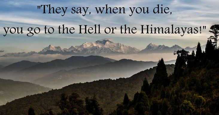
Himalaya is the name of the worlds highest mountain range running along the top of the Indian subcontinent. The term is also used to refer to a much larger mountain system that includes, in addition to the Himalaya Range, neighbouring ranges such as the Karakoram and Hindu Kush ranges. (Im assured that the locals put the stress on the second syllable: Him-al-aya.) Mostly, both the range and the broader mountain system in the English-speaking world get called simply The Himalayas.
This Himalaya tour is further to the west of the cluster of high peaks in the map; and will head pretty much due north from Delhi to Manali; then right through the main Himalaya Range, which, as it continues east, takes in the Annapurna massif, which dominated the surrounds of Pokhara in Nepal, where we did our parahawking, before merging with the ridges that house Mt Everest and neighbouring peaks, and then continuing past Darjeeling in the shadows of Kangchenjunga before taking in Bhutans sacred mountain of Jhomolhari. We travelled under the mantle of all these mountains during out Nepal/Bhutan tour. On this Himalaya tour, there were several peaks along the way that rose to 6,000m and higher; and several passes that we crossed higher than 5,000m. It was a very much an up close and personal encounter with Himalaya. The Lure and Fears of Himalaya Ive had several of my fellow travellers from previous Meanders Abroad seek to persuade me to do the Himalayan Heights tour of Ferris Wheels, with whom I had done five previous trips. While theres a lot about the Ferris Wheels tour that had initial attraction, I consistently stumbled on the apprehension of tackling the treacherous (or imagined as such) riding: the narrow, mud-covered roads, with their precipitous drop-offs, Tata trucks and busses coming around the corners two-abreast, the multitude of water crossings as snow-flow tumbled down the mountains!
But, like my approach to other trips, once I crossed a certain threshold for whatever reason, something takes hold of my thoughts, emotions and determination. I hadnt been convinced of or committed to previous trips until the crossing of that threshold, which usually came about through a sudden emersion into research on locations, people, history, culture and overall tourist attractiveness. It was then like Pauls enlightenment on the road to Damascus. And you wondered why it had taken so long to see. There was one significant difference between Himalaya and other tours: with the others, it was just a matter of time. I was always disposed to look into them. I just had to get around to it. With Himalaya, I had made up my mind to rule it out without any further preliminaries. But that changed. Some fellow travellers from the Nepal/Bhutan tour had recently done a tour across the Himalaya with an India-based company managed by an Brit; and were planning to do another. Having been approached to join them, my first, second and third reactions were to decline - firmly - their overtures. Somewhere in this process, I idly checked out the tour more out of curiosity than anything else. My first foray into doing this confirmed all my previously established fears. Then, imperceptibly, enticements emerged slowly from behind the shadows.
In preparation for the tour, I prepared a rough guide, as I have done in the past, copying unashamedly from Internet sites. Hopefully, the guide will add to your appreciation of the content of the tour; and perhaps whet your appetite. You can access the guide here: Himalaya Tour. I spent some extra time catching up on sights in Delhi and Agra; but Ive described them on a page under Non-Motorcycle Meanders: Delhi and Agra. This page is an amalgam of several visits to Delhi and Agra. Map of the Tour The map, which I have inserted in Satellite mode because its more interesting to zoom in on the passes and switchbacks in that mode, shows a combination of what was planned (but not always possible because of road closures) and what was added in as alternative options. The yellow markers are the passes. You can change the map to Map mode to get a better idea of the locations relative to cities. And if contour lines are your forté, you can switch to Terrain mode.
The planed schedule was to fly from Delhi to close to Manali about 400km north of Delhi. We had early warning that the planned internal flight from Delhi to Bhunter in the Kullu Valley just south of Manali was no longer running owing to the demise of the domestic arm of Kingfisher Airlines. The tour provided for bike collection in the vicinity of Manali, so we travelled by a full-size touring coach with semi-sleeper seats for just nine of us. Needless to say, as compensation for an expected 12 hour (turned out to be an 18 hour!) coach trip, the coach was amply laden with eskies of beer, soft drinks and water. Then there were the duty-free refreshments most of us had arrived with. Plus the several meal stops along the way. Having got away from Delhi around 10:00am, we arrived at our hotel near Manali in time to see the first sparkle of dawn before getting a few hours sleep ahead of being introduced to our Classic Royal Enfields. Getting Ready for the Passes Over the next couple of days, we first took a short ride along the Kullu Valley to familiarise ourselves with the various idiosyncrasies of the Royal Enfield; then a days ride up the more challenging Parvati Valley to the pilgrimage town of Manikaran, sacred to both Hindus and Sikhs. The town is known for its many temples, hot springs and scenery. While we had options for trying the hot springs, our main objective was to master the bikes ahead of our assault on the Rohtang Pass the following day.
These days also provided the opportunity to meet the support crew and get some idea of what to expect from them and the terrain. There would be eight of us (nine including the tour leader) with a support crew of three vehicles and twelve staff. This reflected the fact that we would be camping out on several nights, so the tasks for crew, in addition to motorcycle maintenance, included pitching individual tents for us as well as the kitchen and mess tents, setting up the toilet tent, and preparing the meals. It all worked smoothly thanks to their well-oiled routine.
Mind you, camping in the Himalayas is not everyones cup of tea; and we were pleased not to have had more than two nights in a row before retreating to a hotel.
The descent from Rohtang La down its northern face was rougher than anything on the ascent, with mud and loose gravel on the switchbacks. We also encountered our first water crossings as substantial waterfalls cascaded down the cliffs and ran over the road. I was fast encountering new challenges and even faster having to learn new skills. It was even more of a relief and more comforting to reach our first stop-over on the Manali to Leh Road at Keylong a small, well-established village that becomes totally isolated over the winter months when the passes are inaccessible. We had the comfort of a hotel in Keylong that night, enjoying local hospitality. Baralacha La
I felt decidedly more settled by now. Rohtang La was behind me. I had experienced switchbacks with varying surface conditions, traversed a couple of water crossings, felt the bone-shattering shaking of some of the road conditions, and felt the comfort of predictable gear-changing (apart from the expected false neutrals and an occasional slide of the back wheel as you mistakenly hit the brake when you meant to change gear having the brake lever on the Enfield where you ordinarily find the gear lever on other bikes!). I could tackle Baralacha La and, indeed, the rest of the trip knowing that I could do it! That made such a difference to my outlook and enjoyment.
The descent from Baralacha La brought us down to the area of Sarchu a popular staging post for travellers who stay in one of the tent camps there (thats about all there is in Sarchu). We stopped about 13km short of Sarchu and chose our own camping site, where we had our first chance to see the operation of our support crew. It wasnt long before we had our own sleeping tents in place; and could retreat to the mess tent for an afternoon chai.
It was an early start fortified only by an early chai (or black tea as I preferred) with brunch scheduled at Pang after The Gata Loops and the first two passes of the day. The day started with a relatively pleasant ride on reasonable roads for about 40km before we started the climb to Nakee La and Lachulung La. The first phase of the climb was scaling the Gata Loops, which consist of 21 tight switchbacks in succession that take you up a vertical height of 466m over 7km of road. Rounding the switchbacks made it seem that the road itself was vertical! The road all through the Gata Loops was soft and lose, slippery and inviting the bike to slide. It remained pretty awful as it almost imperceptibly scaled Nakee La at 4,739m and struggled to maintain its hold on the mountain sides to get to Lachulung La at 5,059m. The road down towards the tiny camp of Pang was no better and threw up rocks and water as though both were essential components of the road. Pang, humble as it was, was a welcome rest for brunch and chai before heading across the More Plains and the next high pass of the day in Tanglang La. T
Despite its altitude, the climb to the top of the pass was not as arduous or scary as Lachulung La had been; and it was fairly barren, not exhibiting as much snow as other passes we had crossed.
The woodless camping site was initially not prospective for a fire despite the prolonged attempts by Scot, one of our more intrepid fellow travellers, to get one started. Soon enough, Bamaram and one of his staff appeared with wood and cowpats bought from local shepherds. Much to my delight, I was presented with a bottle of top Australian Red as a birthday present (lovingly brought all that way in Scots luggage); and to top it off, Billaram, quartermaster and overseer of the kitchen, produced a chocolate coated birthday cake that he had cooked up in the kitchen tent after pitching camp.
All in all, it was a full-on, exhausting but satisfying ride. And without incident except for two riders who at different times tried to take a short cut between switch-backs only to find the track far too steep for the Enfield to manage. No harm done. Just a little hurt pride. As we climbed towards the top of the passes, the poor Enfields would frequently give a cough or three or four as the engine gasped for oxygen that simply wasnt there at the altitudes were we reaching. It was necessary to back off on the throttle until it caught its breath or reach down and turn the petrol tap off a tiny bit to reduce the flow of petrol to match the reduced amount of oxygen available. Leh
The hotel in Leh initially had more shortcomings than benefits. It had all the potential to be a quaint, serviceable hotel of more than sufficient comfort and convenience. However, being more accustomed to local clientele, it needed a hurried make-over, which it duly got. On a more positive note, our support crew took over the hotel kitchen, so our meals were excellent. We also had drinks left over from a joint purchase in Manali (we didnt drink much en route because of the effects of the altitude) so pre-dinner drinks in the garden were de rigueur (not to mention Kays morning coffee with a twist (of Kahlua)). Leh provided endless shopping forays; and purchases I had no intention of even contemplating, like a silk carpet! But it was all good fun.
Alchi Monastery
The monastery is in fact a complex of buildings in the near-by vicinity. The Alchi Sumtseg in the complex is one of the most outstanding buildings. The Sumtseg is a three-storied building, though small, built with loam and natural stone in the Tibetan building tradition. However, the woodwork columns, facades, walls, clay images and paintings in the interior of the monastery were made by Kashmiri artists. The sanctum in the ground floor and the first floor has images of three Bodisattvas (a Bodisattva is an enlightened being), all in standing posture and about 4m in height. Most of the Sumtseg is well preserved in its original form, as built in the early 13th century. Chang La and Pangong Lake
We had a great ride over Chang La with a height of 5,360m. This, as with all the passes, is the height of the pass itself, which is overshadowed by the peaks of the surrounding mountains on both sides of the pass. At 5,360m, Chang La could well be the highest pass we cross, despite the claims, accolades and boasts relating to Khardung La, which claims to be higher and, indeed, the highest motorable road in the world. (More on that below.)
Once down from Chang La, the road improved and snaked along valley walls for mile after mile, changing from one valley to another, as it made its way to Pangong Lake. The lake sits at 4,350m and 60% of its length lies in China (or Tibet, as is often claimed). Having no out-flows of creeks or rivers, the lake is saline and has high mineral content. It has spectacular colours of blue and green, with a backdrop of high, barren hills of almost every shade of brown. We camped a few kilometres back from the lake (supposedly less cold) and were entertained Once we broke camp, it was a lengthy ride along a deep valley until we gradually approached the evident end, where the walls seemed to meet, with their snow-capped tops. As it turned out, there was an unseen valley going off to the left, which we tuned into. This valley broadened into a wide base with even higher sides. We had done all this coming to Pangong Lake the day before, but the network of valleys had not been so evident.
The next days plan was thwarted by a rock fall on Wari La which would prevent us getting into the Nubra Valley. So we headed back to Leh for the night. That was a disappointment, but not entirely unexpected where conditions can change so quickly. Khardung La
Khardung La has considerable controversy about it. Its been long claimed to be the worlds highest motorable pass; and signs at the top attest to that, although the signs, so clear on Internet photos, all seem to be drowned in prayer flags. Modern GPS surveys suggest the height of the pass is 5,359m rather than the claimed 18,380ft, which would be 5,602m. That puts it on par with Chang La, which we crossed the day before. Irrespective of the controversy, we are talking significant heights above 5,000m almost two and a half times the elevation of Mt Kosciuszko and significantly higher than any pass in the European Alps. Khardung La is almost overlooking Leh; not that you can see one from the other. But the road to Khardung La seems to start in the middle of town; and it isnt long before a gradual climb commences. For most of the way, the road was sealed, although narrow with a centre line of thick sand. It ran along valley walls for reasonable distances before switching sides and climbing up the next wall. Eventually, the bitumen ran out, the road sharply deteriorated into sand, gravel, rocks and fanned-out water running across or down the road. The climb got steeper and the switchbacks came into play. All this for about the last 20km to the top.
Notwithstanding the doubts about Khardung Las claim, it was satisfying to have made the top. If everyone else that gets to the top of the pass boasts that they have conquered the worlds highest motorable pass, why shouldnt we? But I did avoid buying a T shirt to that effect. Instead I had one embroidered that simply recorded that I had crossed five passes higher than 5,000m! (Even that has turned out to be inaccurate since we didnt cross Wari La.) We were back in Leh by 1:00pm to heat and sunshine. In fact, Khardung La had been the only place where we felt some snow flurries and a decidedly cooler temperature than at any of the other passes.
Hemis Gompa
We took a back road to return to Leh to avoid crowds already gathering as we came out of Leh to celebrate the Dalai Lamas birthday. The back road, we were told, would be okay because recent reports had indicated that there was no water on it. Ha! We had at least six or seven major mud-bottomed, deep and wide, in effect, billabongs to negotiate; plus some pretty rough roads although nothing like the roads across the passes. Expecting the days ride (in 30°) to be a straight-forward bitumen cruise, I hadnt quite dressed for the water! We all made it back without any drowned bikes, but to a less than impressed Vijay who felt personally responsible for the upkeep of the bikes. Back to Delhi It was an uneventful flight back to Delhi, but not before we had a full-on celebratory dinner in Leh that provided us the chance to revel in the exploits and triumphs of the voyage.
We had a quiet final afternoon in Leh capped with local cheeses, the bottle of the Australian Red that I had been presented with on my birthday and other alcoholic beverages that needed demolishing before the next days flight. We caught up again with Scot in Delhi. He hosted us all to lunch at the Imperial Hotel in Delhi an institution that epitomises the Raj and Empire days of early India. The monsoon had made its first appearance the day before we arrived in Delhi, bringing not only rain but the first day in over five weeks when the temperature dropped below 40ºC. It was a very pleasant feeling to breathe humid air at a sensible altitude after coping with the extraordinarily dry air and the high altitudes. In Leh and over the passes, every air passage had felt as though it had been artificially sucked dry to the point of hurting; and every physical effort was so debilitating. Ive never felt so welcoming of stepping out into the full strength of a humid monsoon day!
Here is the photo album of the tour.
Return to top of page Go to Meanders Abroad |
 The Himalaya Range itself has several of the worlds highest peaks; and the greater Himalaya mountain system has all fourteen of the Eight-thousander Club the peaks over 8,000m high. Dylan, my grandson, and I got to see many of them on our
  I was convinced that I would never do the Himalaya. I was determined I would never do it. There was some rational or not fear that kept me away from any serious consideration of it.


